
Map and GPS track
Route Description
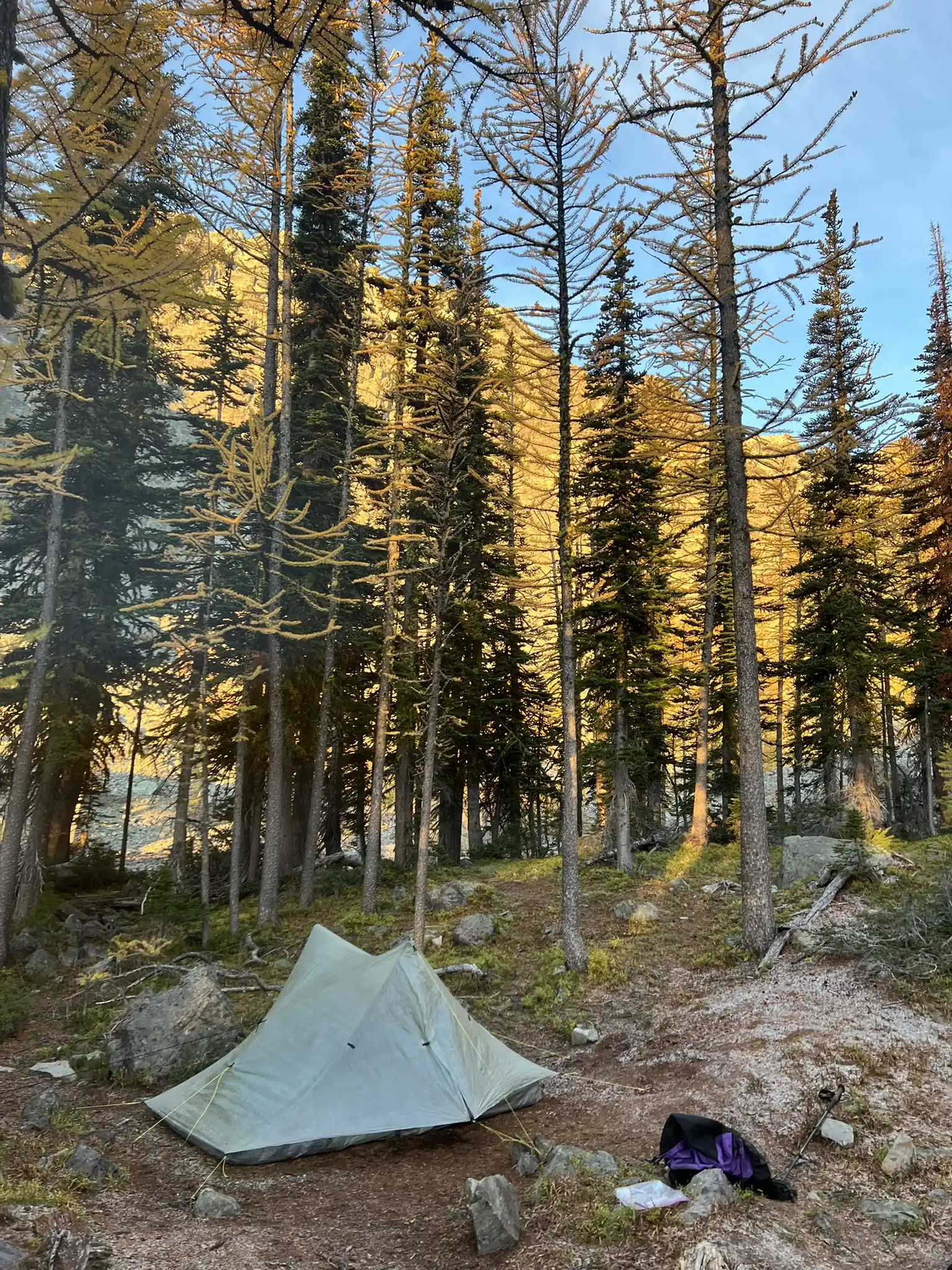
The route follows the trail and turns off near a small tarn. After a short section of bushwhacking and hikes along the left side of the creek, there is a good campsite at 6600 ft (48.75495, -120.33296). There is no water after the creek crossing at 6400 ft (48.75264, -120.32883), so carry enough water from that point.

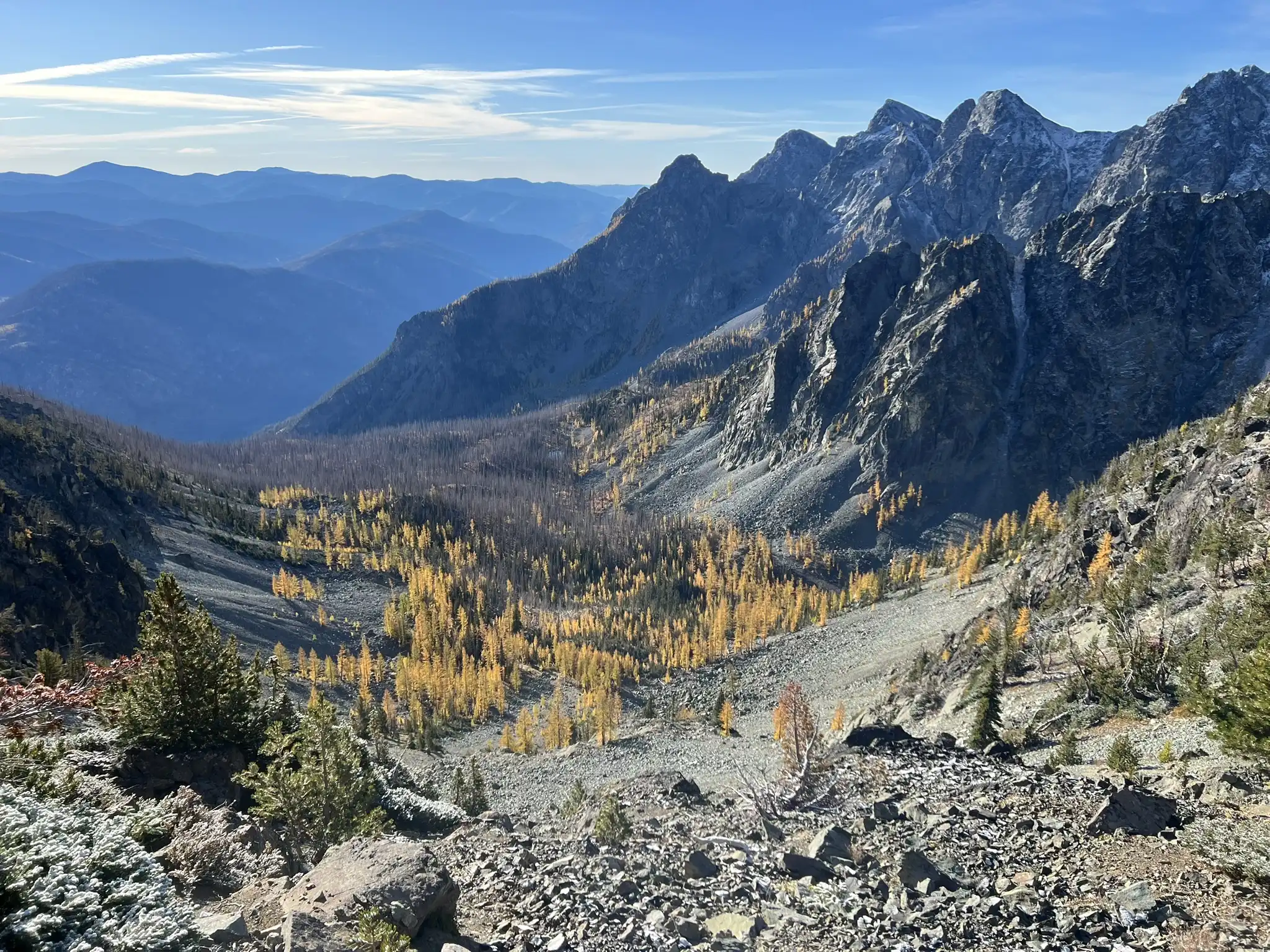
Routes for both Big Craggy and West Craggy are straightforward with GPS assistance. From camp, ascend to the right of a buttress to reach the saddle between the two peaks. From there, Big Craggy is an easy class 2 scramble to the summit. For West Craggy, return to the saddle and pass to the left of a gendarme, then climb a loose gully to a notch. From the notch, cross two small bowls to reach the opposite side of the mountain. The terrain eases into a medium-sized boulder field leading up the final 300 ft to the summit.

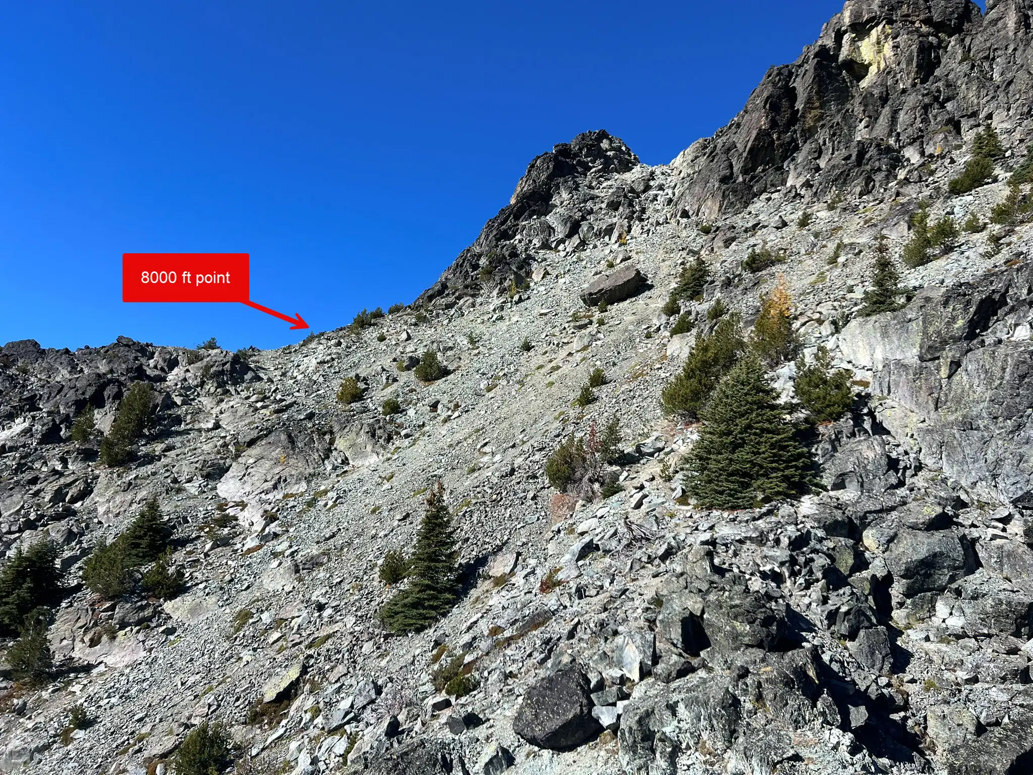
You can retrace your steps back to camp, but we chose a more adventurous descent directly from the 8000 ft point. From there, a scree slope leads downward, but hidden cliff bands lie below. Some route finding and short class 3 downclimbs are required to reach the basin. Once in the basin, follow the boulder field drainage back to camp.
Trip Report
Day 1
We left home around 8:30 am on Saturday, stopped for lunch in Winthrop, and arrived at the trailhead around 2:30 pm. It was a long drive. To our surprise, about twenty cars were already there. We had expected fewer people given the remote location, but Copper Glance is apparently a semi-popular hike, especially during larch season.
The entire trail passes through a burn area, but the trail is in great shape. We went off-trail before a tarn following our GPS track. The route we took on the way up wasn’t ideal, but on the descent we found a better way that stays on the left side of the creek—definitely the preferred option. At 6400 ft, we stopped to cook dinner since we didn’t want to carry extra water to camp for ramen. Keep in mind there is no water beyond this point.
As we reached camp, snow started falling. That was unexpected since none of the weather models on Windy had forecasted it. The snow became heavy at times, so we quickly set up our tent at 6600 ft and retreated inside for the evening.
It took about 3 hours to reach camp with 2800 ft of elevation gain.
Day 2
The night was cold, dropping to about 28 degrees. We had planned to start hiking before sunrise but didn’t get going until about 30 minutes after. A thin layer of snow covered the slopes near the saddle and big craggy, making the west ridge of Big Craggy a little slippery. Thankfully, the climb was still straightforward and the slick rock only slowed us down slightly.

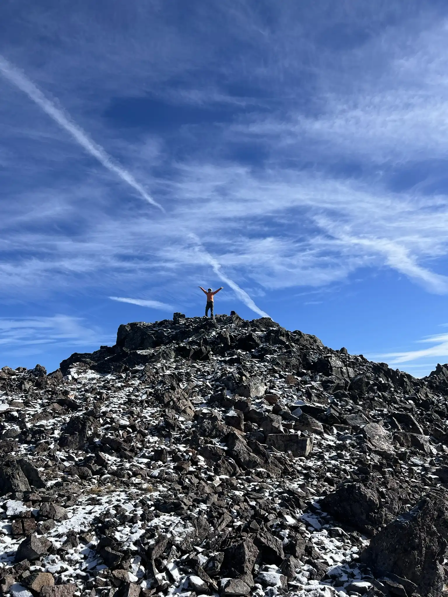
After summiting Big Craggy, we returned to the saddle and traversed the ridge toward West Craggy. This route is less direct though snow free. We aimed for a notch, crossed two bowls, and reached easier terrain on the far side. For the descent, we decided to drop straight down from the 8000 ft point on the ridge. At first we couldn’t see the route, but since many others had descended that way, we gave it a try. It turned out to involve some class 3 downclimbing through a cliff band with some exposure. A fun variation, though not necessarily faster. If you prefer to keep the trip at class 2, retracing your route is the better choice.

The day took 10.5 hours total back to the car, with 2800 ft of gain and 5600 ft of descent.
