Map
Route Descrption
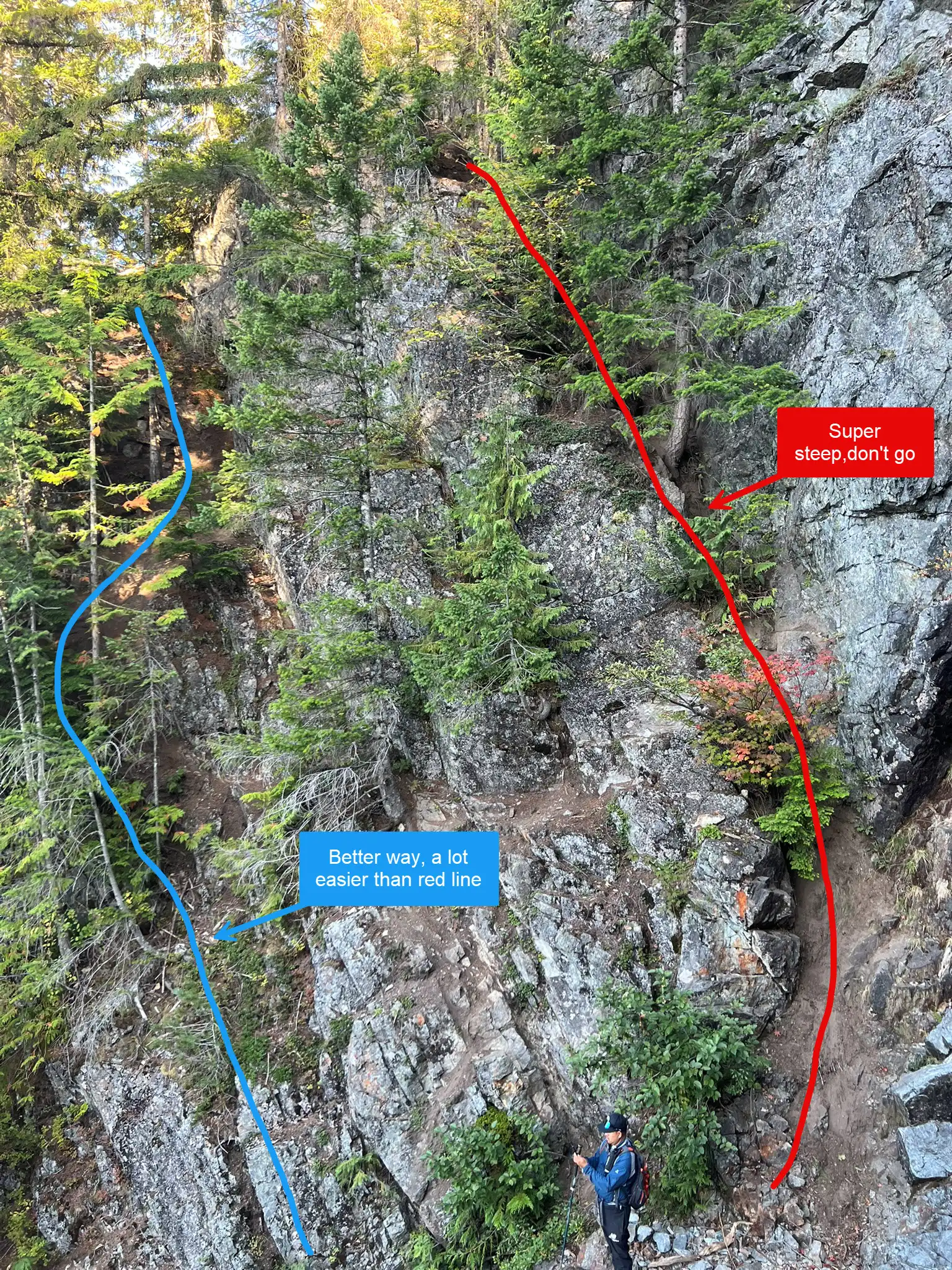
From the spur road, cross Barclay Creek. The trail is faint after the creek, but any boot path will take you into a steep clear cut that climbs steadily. Around 4000 feet, you will reach a gully. Do not drop left against the rock wall since it is very steep and loose. Instead, backtrack slightly and look to the right for a much easier boot path going down.

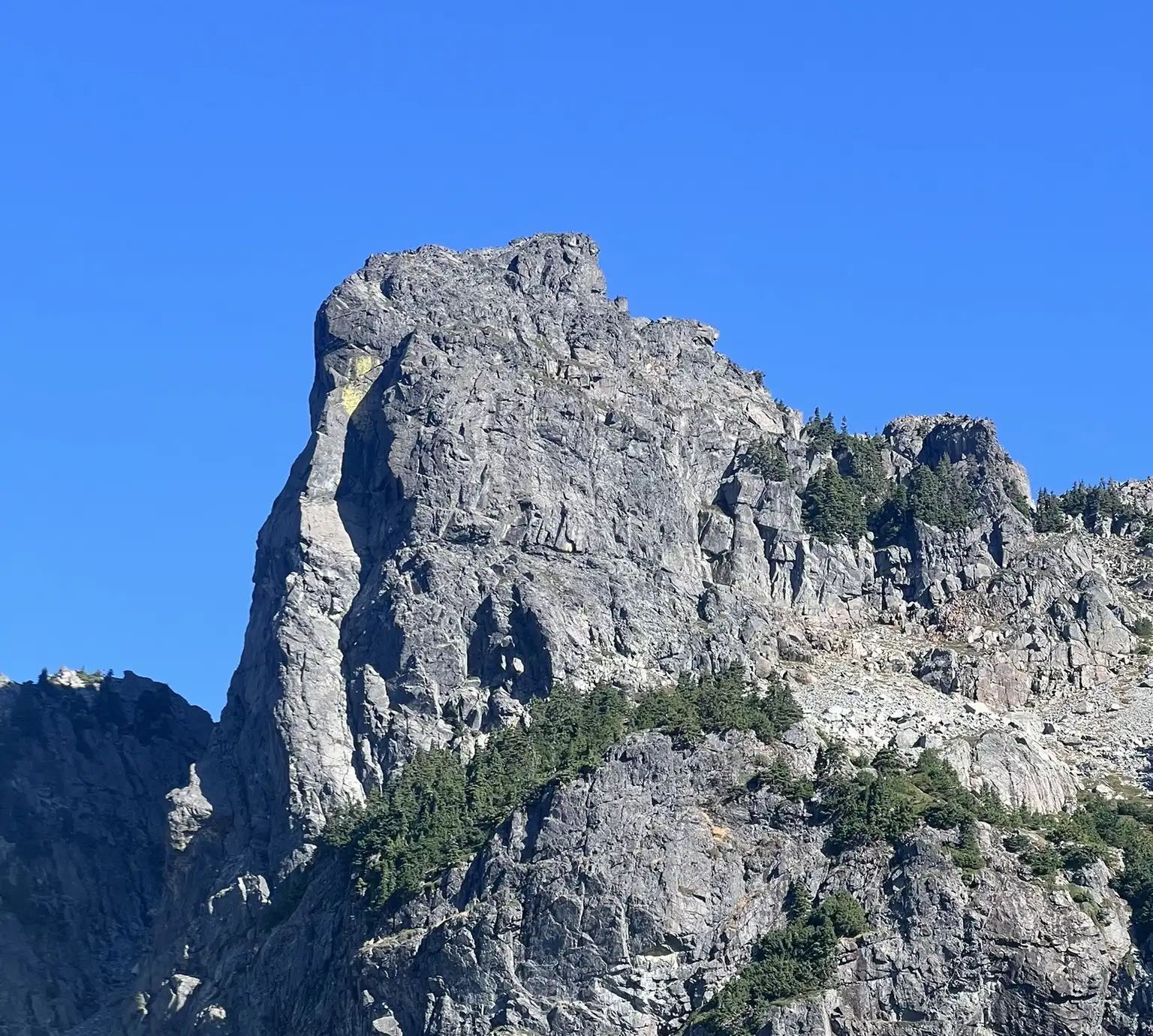
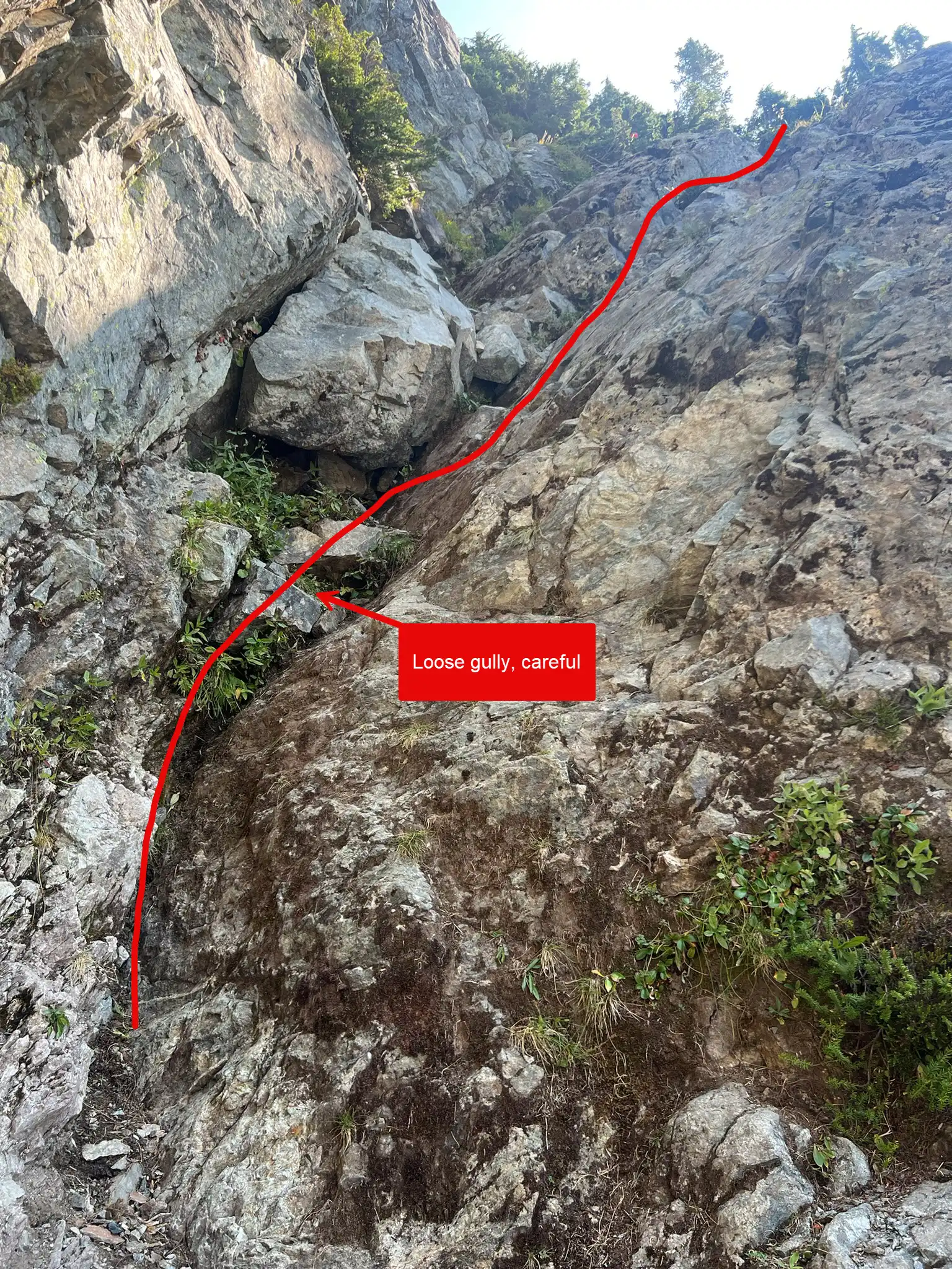
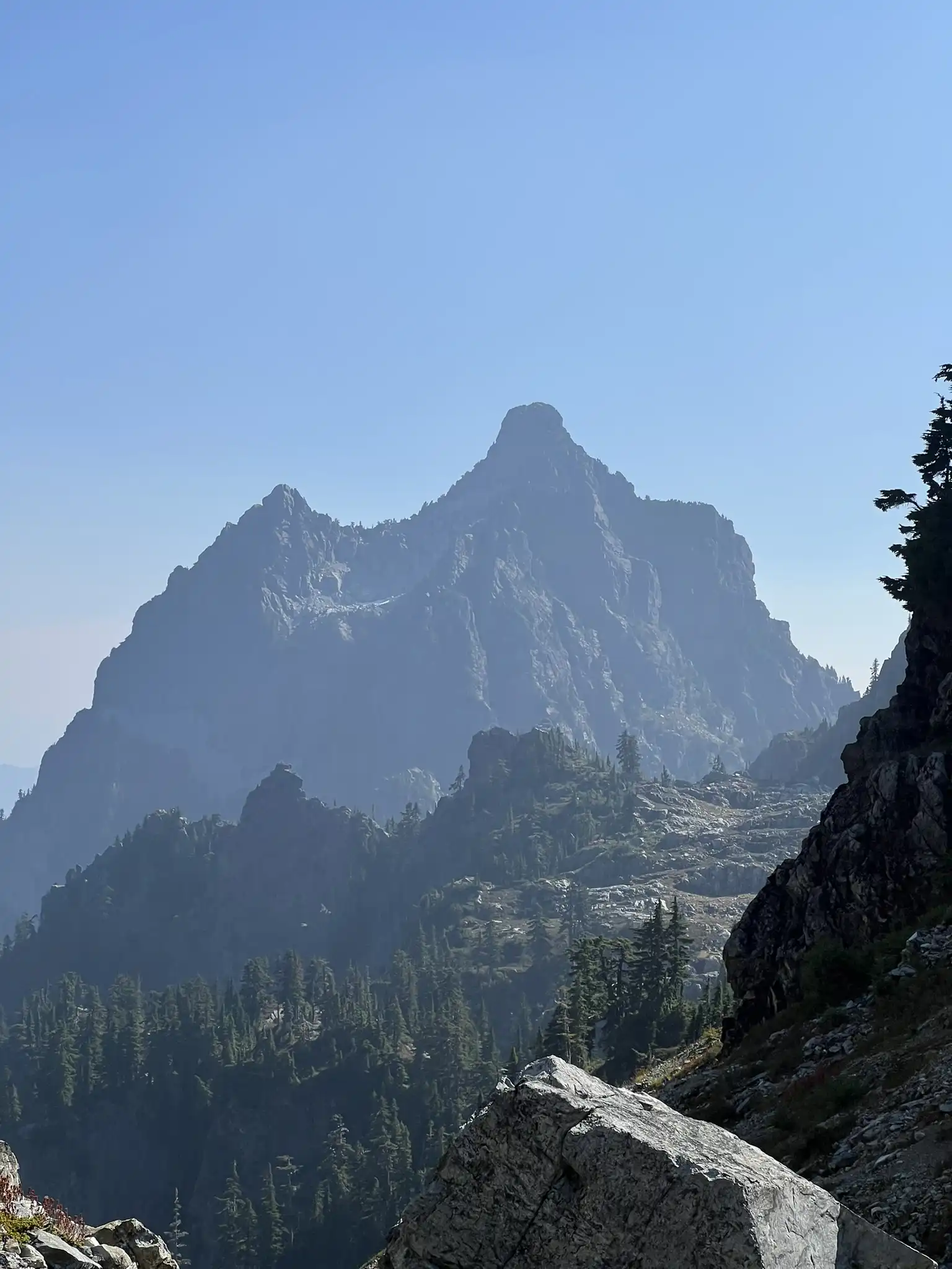
Continue on the defined trail to the saddle between Tailgunner and Wing Peak. Soon you will reach a boulder field where the full route comes into view. Climb up to the so called “hidden ramp,” which is not really hidden with all the available beta. The ramp with its chokestone is the crux. We climbed the class 3 chokestone “chimney”. The holds are not good and the gully is loose, so extra caution is needed.

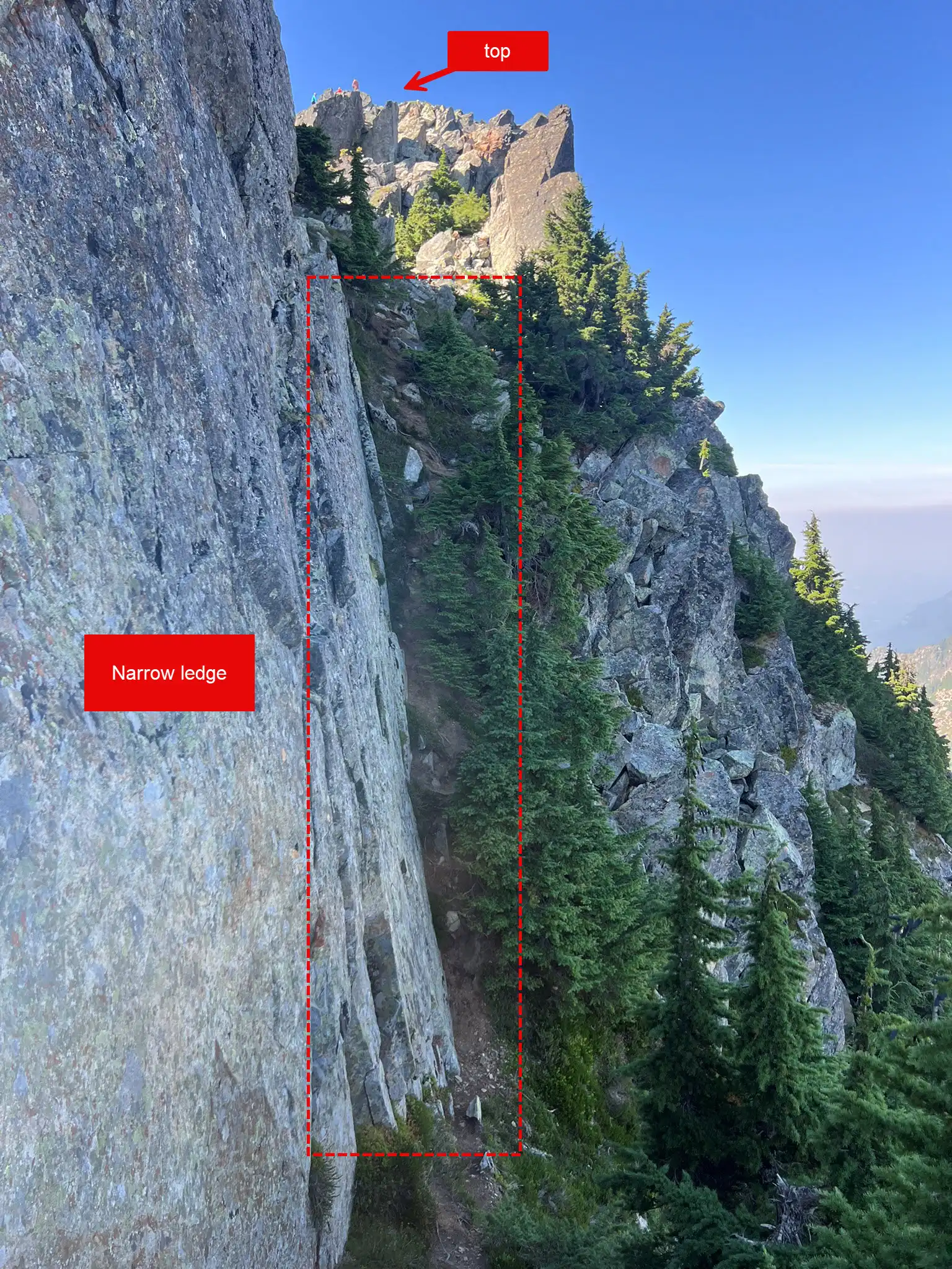
Above the chimney, a boot path leads to a sharp notch on the north side. A short exposed ledge traverse brings you to the final scramble. The path is solid, with trees and brush for handholds. Another quick scramble puts you on the summit.

Trip Report
Chutang and I started around 7 am on Saturday near the Barclay Creek Trailhead. The lot was small and already full, so we parked by the spur road with several other cars. To our surprise, there were about 15 parties on the mountain. The guidebook’s claim that you will have the mountain to yourself no longer seems to be true.
We expected a clean creek crossing but never found one. Luckily, there are many workable options, and crossing was not a big deal. Once across, the boot path was easy to follow almost the whole way to the summit, with just a few class 2 and 3 steps. At the 4000 foot gully, prior beta paid off. We went back and looked right for a crossing instead of committing to the loose left side.

The steep trail soon led us to the boulder field and traverse. With GPS, the hidden ramp was easy to spot about halfway up. The boulder field itself was fine with solid rock, but the ramp had loose sections, so we took care not to knock anything down. The holds were not great, but they were manageable.
Above the ramp, the trail reappeared through trees. We then traversed right and aimed for the V notch. On the north side, we used trees to grip and the rock wall along a narrow ledge. It looks intimidating in photos but felt fine in person. A short scramble later, we stood on the summit of Gunn Peak. The views were fantastic despite the haze. On the way back, we stopped by Infinity Tarn, a quiet little spot and a nice bonus.
GPS: https://www.peakbagger.com/climber/ascent.aspx?aid=2990924
